Northern Flying Squirrel
Glaucomys sabrinus
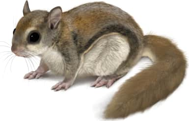
This is a medium-sized flying squirrel with a brownish to grayish-brown dorsal coat and a creamy or whitish underside. It has large, prominent eyes and a broad, furred me…
How to identify
This is a medium-sized flying squirrel with a brownish to grayish-brown dorsal coat and a creamy or whitish underside. It has large, prominent eyes and a broad, furred membrane (patagium) extending between its wrists and ankles, used for gliding. The tail is moderately long, flattened, and bushy.
Range
G. sabrinus is found across a large portion of North America, including parts of Canada, Alaska, and the northern United States, extending south into some mountainous regions.
Habitat
This species inhabits a variety of coniferous and mixed coniferous forests, often favoring older forests with abundant snags and cavities for nesting.
Similar species
G. sabrinus can be difficult to distinguish from Glaucomys volans, but G. sabrinus is generally larger, has a furred upper surface of the gliding membrane near the body, and often has a grayish or darker appearance.
Name and etymology
Genus
Glaucomys
Greek for silvery (glaukos) mouse (mys)
Origin
Sources
- Palmer, Index Generum Mammalium (1904) ↗
Palmer, T. S. 1904. Index Generum Mammalium: a list of the genera and families of mammals. North American Fauna 23. Government Printing Office, Washington. https://doi.org/10.5962/bhl.title.39809
Species epithet
sabrinus
Latin for Sabrina
Origin
Sources
- Wikipedia: Glaucomys sabrinus ↗
“Glaucomys sabrinus.” Wikipedia. https://en.wikipedia.org/wiki/Northern_flying_squirrel
Explore more names in the etymology index.
At a glance
Range
G. sabrinus is found across a large portion of North America, including parts of Canada, Alaska, and the northern United Stat…
Habitat
This species inhabits a variety of coniferous and mixed coniferous forests, often favoring older forests with abundant snags…
Guide
Mammals of North America
Range map
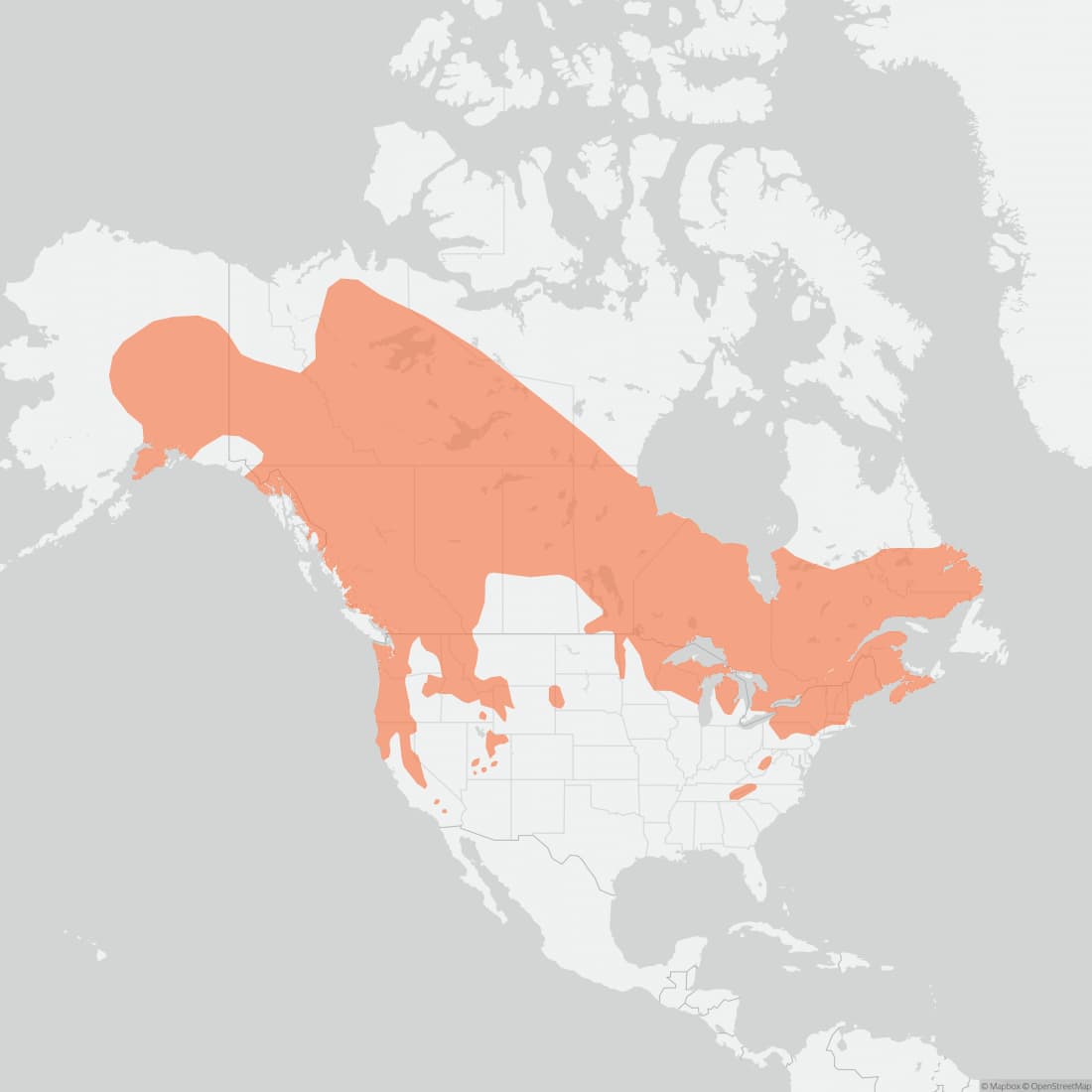
Approximate range. © Mapbox © OpenStreetMap