False Map Turtle
Graptemys pseudogeographica
Adult males are typically 8 to 14 cm in length whereas the females are far larger in size measuring 20 to 26 cm in length. This turtle has a dark olive green carapace wit…
How to identify
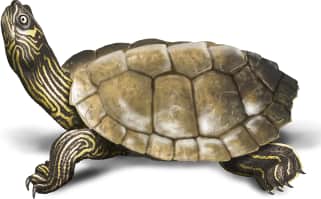
Adult males are typically 8 to 14 cm in length whereas the females are far larger in size measuring 20 to 26 cm in length. This turtle has a dark olive green carapace with a sharp back edge and a high dorsal keel in the middle. Its skin is dark in color with bright yellow lines flowing down its neck and limbs.
Range
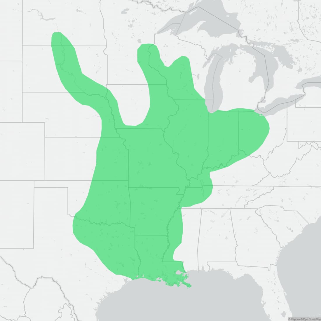
The False Map Turtle is widely distributed throughout the areas of the Mississippi and Missouri Rivers. They have been recorded in the states of Arkansas, Iowa, Indiana, Illinois, Kansas, Kentucky, Louisiana, Minnesota, Missouri, Nebraska, North Dakota, Ohio, Oklahoma, South Dakota, Tennessee, Texas, and Wisconsin.
Habitat
This species frequents large rivers and backwaters. They are often seen along riverbanks and lakes, as well as basking on driftwood and large tree trunks in the middle of slow-moving bodies of water. They are very strong swimmers and spend much of their time in the water.
Variations
There are two different subspecies in this species the False Map Turtle (Graptemys pseudogeographica pseudogeographica) and the Mississippi Map Turtle (Graptemys pseudogeographica kohnii).
Similar species
There are other similar species of Map Turtles in Northern America but the main difference between the Mississippi Map Turtle and other Map Turtle species is that Mississippi Map Turtles have bright yellow reverse-crescents under their eyes and lack the spots displayed by similar species.
Name and etymology
Genus
Graptemys
Greek for written (graptos) turtle (emys).
Origin
Sources
- Agassiz, 1857. Contr. Nat. Hist. U. S., Vol. 1, p. 436 ↗
Graptemys. Agassiz, 1857 - Contr. Nat. Hist. U. S., Vol. 1, p. 436
Species epithet
pseudogeographica
Greek for fake (ps) world map (geographica)
Origin
Sources
- (Gray, 1831). Syn. Rept., p. 31
Graptemys pseudogeographica. (Gray, 1831) - Syn. Rept., p. 31
Explore more names in the etymology index.
At a glance
Size
9 to 27 cm
Range
The False Map Turtle is widely distributed throughout the areas of the Mississippi and Missouri Rivers. They have been record…
Habitat
This species frequents large rivers and backwaters. They are often seen along riverbanks and lakes, as well as basking on dri…
Range map
Approximate range. © Mapbox © OpenStreetMap